| a l a s k a j o u r n e y . c o m |
| Southcentral Mountains & Prince William Sound |
|
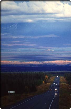
The Copper River gathers the waters of the Talkeetna, Alaska, Chugach, and Wrangell Mountains before cutting its deep path through the Chugach Mountains to the Pacific. Much higher in elevation than the MatSu basin to the west, the Copper Valley does not support agriculture. Residents are few and towns small, but the area’s attractions and accessibility by road make it a popular destination for hunters, fishers, and outdoor adventurers. Ahtna Athabascans lived in the basin for hundreds of years before explorers and trappers arrived in the 1800s, followed soon thereafter by miners. Most prospectors saught gold, but it was copper mining in the Wrangells that had the greatest impact on the region. The establishment of the Kennecott Mine north of McCarthy led to road and railroad building. An important early trade and transport route from Valdez to Fairbanks followed the path of what is today the Richardson Highway. Several Copper River basin communities began as roadhouse and supply locations for both the mine and the overland route. Today the Trans-Alaska Pipeline parallels the Richardson, adding oil-service jobs and industry to the corridor. Visitors usually reach the basin by road via one of four mountain passes, reinforcing its isolated image. Much of the region is forested with white and black spruce, while stands of aspen trees turn brilliant yellow and orange in the fall. In upland and boggy areas, the forest thins, yielding to expansive areas of brush, muskeg, and wetlands. Towns are small and services spread out. The climate is more like that of the Interior than the coast, with extreme temperatures and light precipitation. The high peaks of the Wrangells dominate the landscape and include Mount Wrangell (14,163'), the largest active volcano in the United States; Mount Blackburn (16,390'); Mount Sanford (16,237'); and Mount Drum (12,010'). Many Copper River basin listings are found in the milepost guides for three main highway segments: the Glenn Highway, Tok Cutoff (part of the Glenn), and the southern half of the Richardson. The milepost listings for the northern half of the Richardson are found in chapter 12.
The Slana River bridge near Slana at the head of the Nabesna Road is a recognized put-in for long-distance float trips on the Copper River. The river parallels highways as far as Chitina, then cuts through the Chugach Mountains along the historic, abandoned rail line from Kennicott to Cordova. The take-out is the Million Dollar Bridge near Childs Glacier, 245 miles from Slana. Several shorter routes are possible because of generally easy land access. Class II to IV whitewater stretches are found along the way. To experience the most scenically rugged portion of the route, start in Chitina. Towns on the highway near the Copper include Slana, Gakona, Gulkana, Glenallen, Copper Center, and Chitina. A few outfitters and riverboat services operate along the route (see the Appendix). Consult the rangers of Wrangell–St. Elias National Park and Preserve when planning, as most of the route is within the park boundary (much of it is the boundary). |