| a l a s k a j o u r n e y . c o m |
| Anchorage, Matsu & Cook Inlet |
|
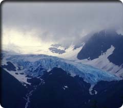
Location/Size: At west end of Chugach Mountains, adjacent to Anchorage. 495,204 acres. Main Activities: Hiking, fishing, kayaking, wildlife observation, short hikes and jogging, camping, cross-country skiing, mountaineering. Gateway Towns/Getting There: Anchorage/scheduled air service from Seattle, Fairbanks, and many other points; vehicle access via Glenn Highway (AK 1) and Seward Highway (AK 2) from Kenai Peninsula, Canada, and the Interior. Park access: vehicle parking with trailheads at Crow Creek Canyon via Girdwood; Bird Creek, Indian Creek, and Falls Creek, all along Turnagain Arm; Ship Creek via Ski Bowl Road and Arctic Valley Ski Area; Peters Creek and Eklutna Lake from the Glenn Highway; and Pioneer Ridge from the Knik River Road. In southeast Anchorage, several trails can be reached from Rabbit Creek Road, Hillside Drive, and Hilltop Ski Area. Facilities, Camping, Lodging: Visitor center, parking lots, access roads, dump station, picnic sites, and viewpoints all around the park perimeter, at campgrounds, and along the highway. Eklutna Lake Campground, Mile 10 Eklutna Lake Road; Eagle River Campground, take Hiland Road toward mountains from Mile 12 of Glenn Highway (AK 1); Bird Creek Campground, Mile 101 Seward Highway. Primitive camping in park interior, a few designated sites. No backcountry lodging. Headquarters and Information: Visitor Center, Mile 12 Eagle River Road, 694-2108, open daily in summer 10 a.m. to 5 p.m.; Chugach State Park Headquarters, Mile 115 Seward Highway (AK 1), 345-5014; Eklutna Ranger Station, Mile 10 Eklutna Lake Road, 688-0908, www.dnr.state.ak.us/parks/units/chugach. While several American cities are backed by mountain wilderness parks, Anchorage tops them all. At nearly half a million acres, Chugach State Park is the third-largest state park in the United States—there’s plenty of room for solitude. The east-central section of the park is crowned with an almost continuous layer of glaciers, while to the west and north long valleys drain northwestward into Cook Inlet. The towns of Eklutna, Peters Creek, and Eagle River are at the mouths of three such valleys, while Ship Creek and several smaller streams flow through greater Anchorage. Eagle River Road follows the Eagle River a dozen miles into the mountains, providing access to a popular river run. Intermediate or advanced canoeists, kayakers, and rafters can enjoy Class I to Class III waters. The best put-ins are at Mile 7.5 and Mile 9 of the road. See the appendix for outfitters. Virtually every watershed draining the park has vehicle access and trailheads. Thirty trails are identified by the park service, including six open to mountain biking. Most are short hikes up into closed valleys, though they allow access to high ridges and peaks. Several short spurs and loops climb up from the foothills neighborhoods above Anchorage. With so many options, it pays to stop for information at the Eagle River Visitor Center at Mile 12 of Eagle River Road, the Chugach State Park Headquarters at Mile 115 of the Seward Highway, or the Eklutna Ranger Station at Mile 10 of Eklutna Lake Road (see details above). Chugach State Park Trails The routes listed below include all designated through trails, most longer trails, and a few shorter spurs. For details on the shorter trails from the Anchorage foothills, stop in at park headquarters. Arctic to Indian Trail (22 miles, 2,100' and 1,000' gains northbound, 1,000' gain southbound)—This rugged route starts at Arctic Valley Ski Basin at the end of Ski Bowl Road near Fort Richardson, drops 1,000 feet into the Ship Creek valley, and follows the creek south until the trail disappears in open terrain. From here, you may have a difficult, muddy slog up to 2,100-foot Indian Pass before dropping down Indian Creek on the Indian Valley Trail to the trailhead at Mile 102 of the Seward Highway (AK 1). Day hiking to the pass from the south end is a good option (6 miles to pass, 2,100' gain). Through route—2–3 days. Bird Creek Trail (15 miles, 2,500'-plus gain)—Begins at Mile 100.5 of Seward Highway just west of Bird House Bar and follows Bird Creek up to treeline in a high basin. The first 5.5 miles are an old road open to ATVs and bikes. The rest is unmaintained and sometimes overgrown. Cirque and ridge options are possible among 5,000- to 6,000-foot peaks with small glaciers. RT—2–4 days. Bird Ridge Trail (1.5 miles, 2,500' gain)—At Mile 102.1 of the Seward Highway, you’ll find the trailhead for a route that climbs quickly up Bird Ridge, unlike its near neighbor to the east, the Bird Creek Trail, which follows the valley. For a moderate to steep, early season, fast climb to great views, this is a fine choice. The trail ends at the ridgecrest, inviting further exploration. RT—3–4 hrs. Eklutna Lake Recreation Area and Trailhead (various options)—Take the 10-mile Eklutna Lake Road from the Eklutna exit of the Glenn Highway to the recreation area, a designated portion of Chugach State Park which features a good campground near the foot of this long, lovely lake. There are several trail options:
Falls Creek Trail (1.5-plus miles, 1,500'-plus gain)—Officially ending at treeline, this steep climb can be continued another couple of miles through open tundra into a high cirque. Hikers are rewarded with high-country scenery and outstanding views. Dall sheep may be sighted. The trailhead is at Mile 105.7 of the Seward Highway. RT—half day. Glen Alps Trailhead (several options)—From New Seward Highway, take O’Malley Road east about 4 miles to Hillside Drive, turn south 1 mile to Upper Huffman Road, then east again for less than a mile to Toilsome Hill Drive. Follow Toilsome Hill Drive as it winds up to the trailhead. Four trails begin here:
Prospect Heights Trailhead (several options)—From New Seward Highway, take O’Malley Road east about 4 miles to end of road, swing left onto Hillside Drive, then right up Upper O’Malley Road about H mile to fork. Bear left up Prospect Drive to trailhead. Three trails begin here:
South Fork Valley Trail (6 miles, 400' gain)—Follow Hiland Road from Mile 11.6 of the Glenn Highway near Eagle Creek. From Mile 7.5 of Hiland, follow the signs for half a mile to the trailhead. This easy route follows an open valley among high peaks to beautiful lakes, and includes boardwalk segments for crossing wet areas. RT—all day. Turnagain Arm Trail (9.4 miles, 750' gain) The trail begins at the Potter Section House Historic Site and Chugach State Park headquarters at Mile 115.3 of the Seward Highway. The path follows an old rail construction support route, paralleling the highway and tracks southeast along Turnagain Arm. The views are splendid, the separation from vehicle traffic is sufficient, and the trail is open early in the season. The route can be shortened or extended in various ways. Look for Dall sheep. Through trail—all day. Campgrounds Eklutna Lake Campground—50 sites with picnic tables, fire pits, water, latrines, and ranger station. Overflow camping area of 15 sites. Trails for hiking, ATV use, bicycle and horses. Boating and fishing. $10/night. Stay Limit: 15 nights. |